When we started our trip, we had planned to spend a few days in Bryce Canyon, but, when we hit so much heat in Arches, we decided to cancel the original three nights here and journey over one day while we were at Zion with air conditioning. We would not have had that luxury in this park.
This was our day to see Bryce. And what an extraordinary day it was. From the first view to the last view, we were enthralled.
We left Zion by the East Entrance over a very narrow and windy road that brought us through a tunnel that was one mile long. All RVs require an escort through the tunnel and if they are too big, they are not allowed at all. We were in the car this day, so we could go through with no problems. On the other side of the tunnel, we stopped to see if we could spot a desert long horned sheep as this is said to be the spot where they habitate. We saw none, but we did see some very interesting rock formations.
 |
| No specific name, but I loved the colored swirls in it. |
 |
| Patterned Rock |
 |
| Red Canyon Formations |
 |
| Arch on Scenic By Way 12 in Red Canyon |

Of course, the geological causes for the creation of these go back millions of years and I'm not sure we clearly understand it all. The gist of it is that these rocks were formed from beds of sediment that were compressed into rock and pushed up from 3000 feet to 9000 feet in elevation. Their coloring comes from plant roots that helped oxidize the iron to give the sediment a reddish color. The literature tells us that technically Bryce is not really a canyon as canyons are caused by the flow of a river or stream. The hoodoos in Bryce are constatnly being changed by acidic rainwater that dissolves the limestone and rounds the edges of the hoodoos and we learned that the freezing and thawing of water does most of the sculpting of Bryce Canyon.

Our next stop on the tour was Inspiration Point. Here there were three observation points, one of which was when you deboarded the shuttle, but the other two were a definite challenge. We climbed about 400 feet in elevation in about a half a mile. Very steep, but the sights were worth it.

Tim is experimenting taking panoramic pictures
 |
| Hoodoos |
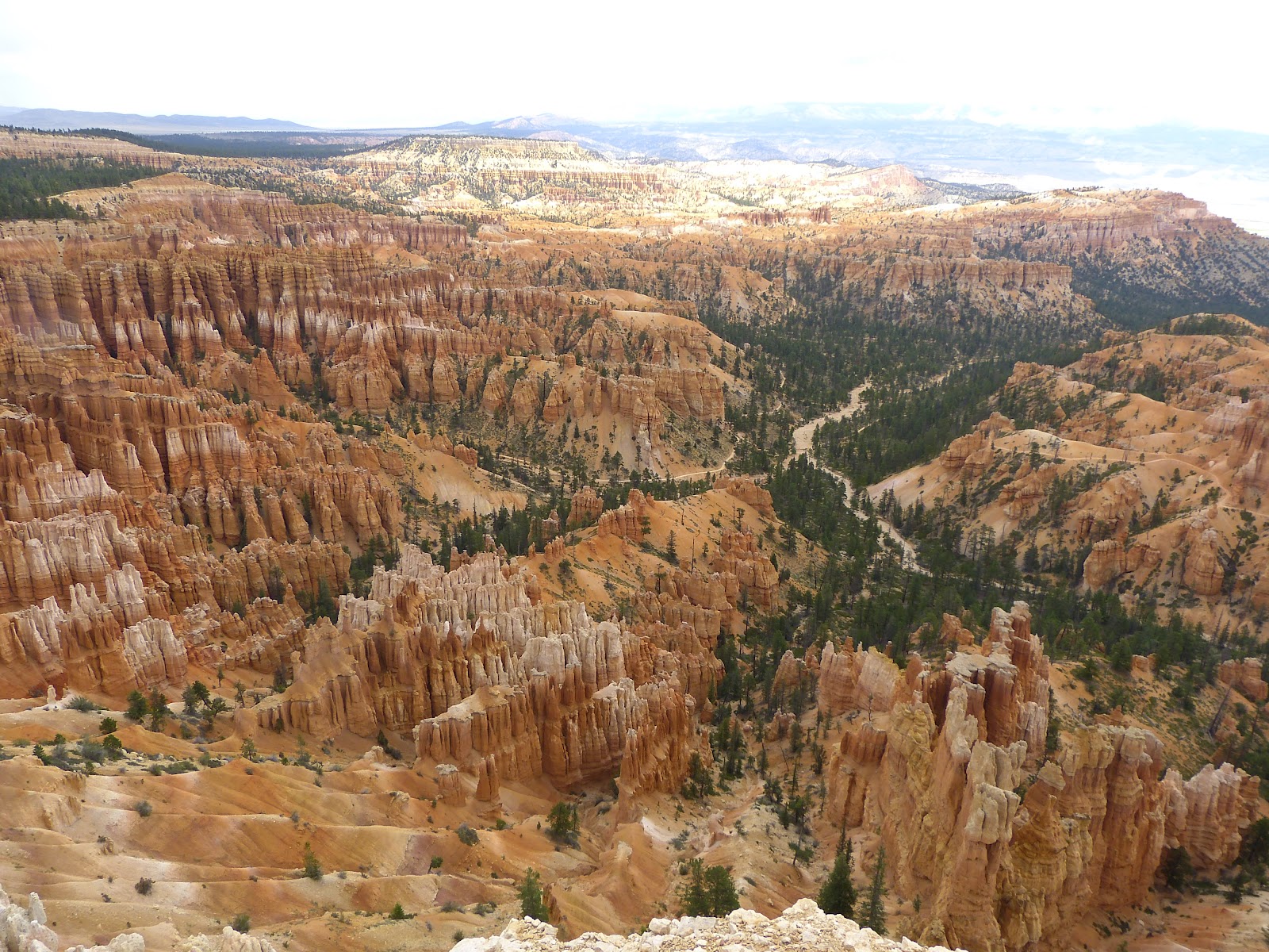 |
| View From Inspiration Point |
When we got back on the shuttle, a thunderstorm erupted so we got off at the Lodge for lunch to wait out the weather. The rain stopped and we continued our journey to Fairyland Point.
 |
| Fairlyland Point |
Breathtaking views surrounded us all day long. You could take pictures until the cows come home and you would never fully capture the beauty of it all.
On the way home on the Zion side of that mile long tunnel, we stopped and took a couple of photos of the tunnel wall and the window openings placed intermittently in it to give light inside as well as photos of the serpentine road.
 |
| Panoramic View of Tunnel Wall with Window Openings |
No comments:
Post a Comment