Sunday, July 29, 2012

PETRIFIED FOREST, PAINTED DESERT, WINSLOW, AZ

July 27th, Friday

We left the South Rim and drove to Homolovi State Park just outside of Winslow. Homolovi is Hopi for land of small hills. It is basically in the desert but on the Little Colorodo River which is pretty dry. There are two ancestral puebloans ruin sites in the park that are basic mounds of ruins with no real structures but has artifacts within the mounds. They are fenced off from the public so that no one can take these artifacts. They were populated between 1200-1300 and left the area for an unknown reason. The Hopi claim them as their ancestors. A lot of the the current day Hopi live on two different Mesas while others live in the surrounding communities.

Once we were settled, we drove into Winslow, AZ so we could see the famous corner from the Eagle's hit "Take It Easy".. "..stand'n on the corner of Winslow, Arizona what a fine sight to see. A girl, my lord, in a pickup Ford slowing down to take a look at me." Other than this corner and the La Posada Hotel which was built by the same man, Harvey, that built the El Tovar and 21 other Santa Fe restaurants and hotels, the town was unremarkable. But it was fun seeing the statue on the corner and taking Tim's picture there.

July 28th, Saturday

We packed our lunch and headed out to the Petrified Forest and Painted Desert. This area was first established as a protected Wildrness area by the Federal Government and then was designated as  a National Monument in 1906 . It was then named a National Park in 1962. The oldest geologic layer called the "Chinle Formation" is 225 million years old and was from the Triassic Period which is before the dinosaur age. They have found fossils from this pre-historic age that resemble our current day crocodile. They say that this land originally was closer to the equater and with the shifts of the earth's crust, it was moved to the southwest portion of the United States and uplifted 60 million to 70 million years ago.

The Petrified Forest is a barren desert like area with fossilized logs that are uncovered from the earth's depths when the rain and time wears away the upper layer of clay. The logs range from full size to chopped smaller pieces that have broken off from the larger logs. They were formed when flooding knocked them over and lava from volcanoes encapsulated them. The capture of water and the slow drying out under pressure, along with the mineral deposits in the tree is the process of petrification. Some have many different colors depending on the minerals and others look crystallized. They were all over the desert and we are told that this area has only about 10 percent of the petrified wood within Arizona so that you can stop and buy some at local shops, but you'd better not pick up a piece in the Park. Fines are heavy duty.. up to 5 years in prison and $150,000 in fines. It was noted in the literature that all states have some petrified wood. In fact, the huge forest that was buried during the eruption of Mount St. Helen in Washington will probably produce petrified wood millions of years from now.

We stopped at several overlooks and viewed the petroglyphs at Newspaper Rock. There were several rocks with petroglyphs on all sides of them.


 We walked through the ancestral puebloan ruins at Puerco Pueblo located near the Puerco River. There was an entire village at one time at this sight and the village outline had been discovered and reestablished by the park.

The Petrified Forest road takes you right into the Painted Desert. As you drive in, you are rewarded with a brilliant display of  buttes and mesas with layers of colors from white to green to pink, purple and red.

At the Kacina Point was also a Historical Monument, the Painted Desert Inn, also built by Harvey and designed by Mary Colter. She had designed manu of Harvey's previous hotels as well which was quite unusual in the early 1900s to have a woman architect even before women got to vote.
Kate in the Desert

We enjoyed the Park and learned quite a bit once again about the geology and history of the area. The skies turned dark and the monsoon rains started just as we completed our tour.

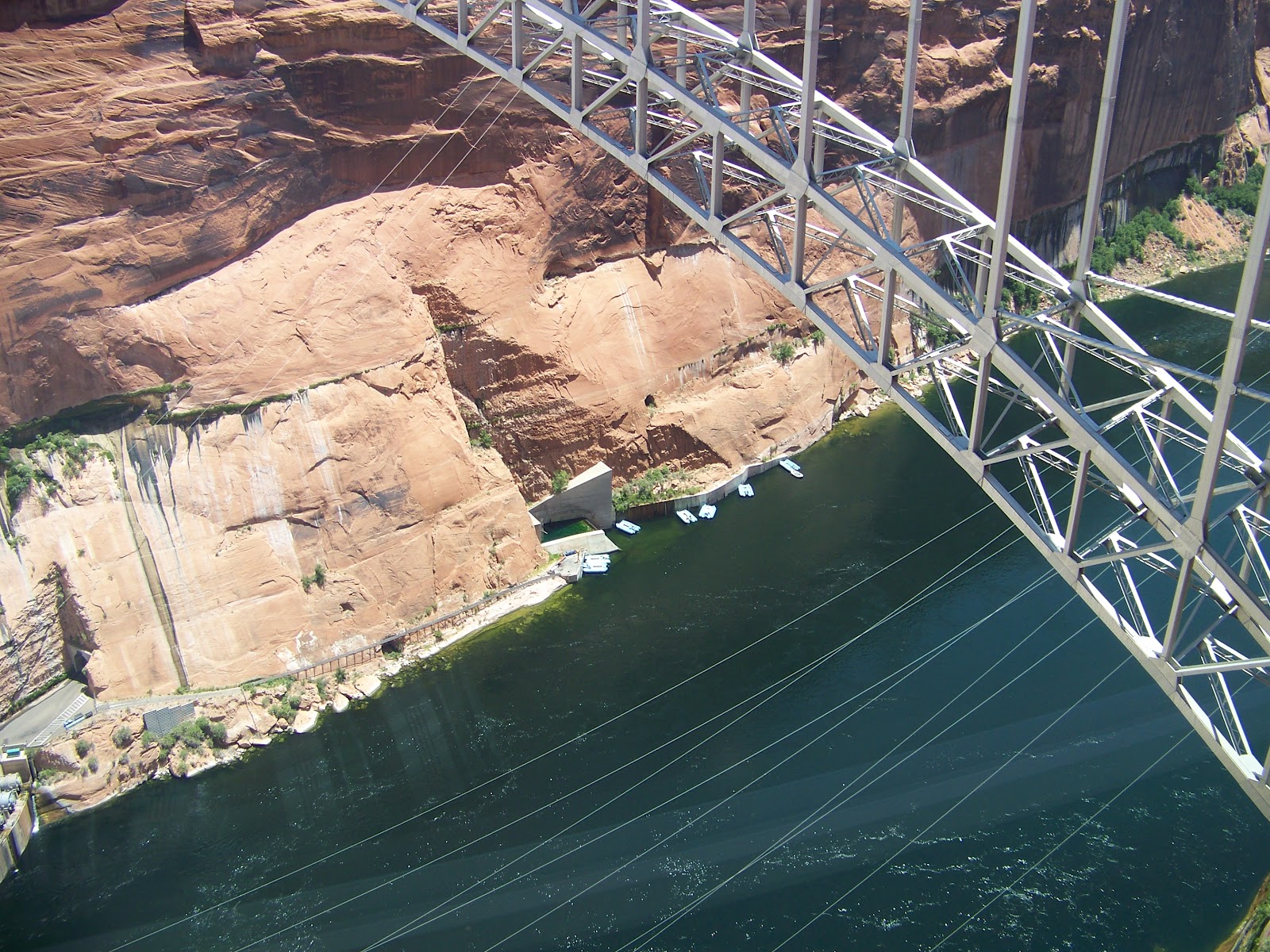
Tomorrow we head to Las Vegas with a stop at the Hoover Dam along the way. 

Friday, July 27, 2012

SOUTH RIM PART II

Tuesday, July 24th

After a night of total thunder and lightening storms, the weather for the morning was still a little drizzly and cool. We ventured over to the El Tovar Lodge to see if our internet would work better.  the El Tovar Lodge was built in 1905 and the story of the builder, Fred Harvey is incredible. He started out as a dishwasher and amassed an empire by working with the Santa Fe Railroad to build eateries and hotels along the train routes, 22 in all. He was also the first to employ female servers. The Lodge, designed by Mary Colter is built out of logs and represents the pioneer and southwestern motifs. It is pretty much the way it has always been and is just 25 feet from the Rim.

Just by happenstance, we were there in time to catch the most amazing sights of the Canyon through fog and clouds. It was surreal and ethereal being above the clouds and the fog hanging over the Canyon like cotton candy. Slowly, the fog dissipated, the Canyon walls came into view, the clouds starting drifting off and the sky lightened around us.

South Rim Fog and Clouds
Starting to Clear

In the afternoon, with clear skies and warm weather, we took the shuttle bus up to Hermit's Rest getting off at several stops and walking the Rim Trail from one shuttle stop to another.  We marveled at the tenacity of some of the folks hiking down into the Canyon on Bright Angel Trail. You can do round trip of three miles, six miles or a two day trip. Most of the people, we think were doing the three mile trip. It is a drop in elevation of 1,121 feet. It is extremely steep with many switchbacks around the Canyon walls. It is the same path the burros take down for a two day excursion. The total trail elevation descent is almost a full mile. Of course, you have to come back up again!

Bright Angel Trail

From each overlook, you saw a different angle into the Canyon.


 From two of them we could see the Colorado River which looked brownish from the sediment drifting down from the Painted Desert. We were able to make out rafts going down the rapids with a helicopter above it. Zoomed to the max to get this shot.

Raft on Rapids with Helicopter Above It


The sun was right for afternoon pictures and the colors were spectacular..all shades of pinks, purples, tans, and golds.

Wednesday, July 25th

We had scoped out the inclines on the way up to Hermit's Rest yesterday with the thought that we would do the same as we did in Zion. Put the bikes on the shuttle bus to the top and ride our bikes down. We also thought this would be easier than hiking until I got adjusted to the altitude again. So, we put on our helmets and bike gloves and pedaled three miles over to the shuttle bus and rode it to the top at Hermit's Rest. We still thought the inclines going back would not be many or difficult. How wrong we were. There were almost as many ups as there were downs and my legs were truly tested. Tim did just fine, of course, but I was ready to throw in the towel and ride the shuttle bus back about 2/3rds of the way down, but instead we rested and climbed the last hill before our wonderful total downhill ride back to the village. We rode the bus back to the campground from the Village though as I just couldn't do three more miles. We did a total of nine on the hills and I was done for the day!

Tim Taking Picture of Colorado River Below

Riding the bikes gave us a great opportunity to stop whenever and wherever we wanted to see the fantastic vistas of the Grand Canyon. We even saw the hideway that was the hermit's way down on the sidewall of the Canyon. We also saw four Condors flying directly overhead. Their wing span is enormous at six feet. They flew over so quickly we were lucky that we got any shots at all.

Condor


Condor Photo Cropped In

 They say there are about 277 condors in the wild. They trap them, examine them and retag them every year. One of the problems they have is lead poisoning which they can get from eating the carcass of a deer that is shot with a lead bullet and left in the wildernes. They are tested for this each year before they are released back into the wild.  There is  now a program where the hunters can exchange the lead bullets for copper ones in hopes that this will remedy the problem.

Thursday, July 26th

Tim had toured the east end of the Park when he was here alone, but today he wanted to visit it with me again. He toured it on his bike, but I have had enough of bikes for a few days, so we took the shuttle bus to Kaibab Point. The shuttle has a few stops along the way and at each overlook there is a different viewing perspective of the Canyon.

Mather Point

 At the South Kaibab Point there is a trail that descends almost 1200 feet in a mile and a half which makes it much steeper than the Bright Angel Point Trail. This trail connects with other trails that will take you across the Canyon to Indians Garden and the Bright Angel Trail. There is a stop along the way for a 1.8 mile round trip but it is still very steep with a 600 foot descent in less than a mile. We did no real hiking today, just short walks to the overlooks which was fine with my sore legs from biking yesterday.

South Kaibab Trail -From top right down to the left at the ridge line.

It is really wonderful that some of the parks have these shuttle buses. Thousands of people use them everyday. Just imagine the congestion and pollution if everyone were to drive their own vehicles through the parks. I will say, though, that we like the North Rim a little better than the South Rim for the sheer reason that it is so crowded here. The vistas are incredible from either Rim.

Thursday, July 26, 2012

SEDONA TO THE SOUTH RIM OF THE GRAND CANYON

July 13th, Friday - July 21st, Saturday

On Friday, we drove down from the North Rim of the Grand Canyon hoping to get a spot in the Pine Flats Campground in the Coconino Forest. We traveled on 89A from Flagstaff towards Sedona. The campground was a half way point between those two cities.  What we didn't know was that there was a restriction on all vehicles over 50 feet long for part of the road to the campground. Our overall length is just about 50 feet, but we were already on the road when the restriction sign appeared and there was no turning back.  The reason for the restirction was that there are 2 1/2 miles of steep switchbacks on a very narrow road. It was one heck of a ride!
Just One of the Switchbacks We Traveled

We made it through the switchbacks only to find that the campground was full as the weekend was upon us. We continued through Sedona looking for another RV park and found one that would do in Cottonwood just south of Sedona. It was great because we actually had electricity, TV and all hookups which we have been without most of our time on the road.  We were only there for two nights but it gave us an opportunity to see a little bit of Sedona, do a little shopping and gave me time to pack up for my trip to Philly to see my daughter, Kelley, for the week.   On Saturday,Tim took me to the Chapel of the Holy Cross which he had seen before on a previous trip to the area.
Chapel of the Holy Cross, Sedona

 It was really an architecural feat. It's built into the red rocks of Sedona and was absolutely packed with tourists. We were told they never hold Mass there because it only has room for 75 people and the priest only goes out to it for private events such as weddings. I thoroughly enjoyed our short visit to Sedona for the day and understand why everyone is so taken with the natural red rock beauty surrounding it.
Red Rock outside of Sedona

On Sunday, the 15th, we left Cottonwood and parked the RV in Pine Flats Campground in the Oak Creek Canyon Valley. Tim took the canoe and the bikes off of the car and we headed to the airport in Phoenix where I was to take the red-eye to Philly. I was at the aiport about 8 hours early so that Tim could drive the 4 hours back to Pine Flats in the daylight and not have to drive in the dark over unlit canyon roads. My flight was cancelled, naturally, but I was able to get on another one with a stop in Denver. The red-eye was just that!

On July 16th, Monday and July 17th Tuesday
 Tim did some relaxing after his long drive on Sunday. He did a few RV repairs (nothing serious) and then he took a short sightseeing ride through Sedona so that he could decide what he would like to do with the rest of his time there.

The morning of Wednesday, the 18th, with waders on, he hiked into areas which had steep rock formations so that he could get to streams and fly cast.He was amazed to find out that the areas that are "catch and keep" are well known to the fish and they don't bite, but the "catch and release" areas are also well known to the fish. In these areas, they greedily grab the hook knowing that they can have their bait, eat it and get released. Tim did just that for five trout! He did do some "catching" he just couldn't keep them. In the afternoon, he hiked the areas near the campground and left the fishing pole home.

Thursday, the 19th, he went to Montezuma's Castle National Park which is an Ancestral Puebloan cliff dwelling similar to the ones we saw in Mesa Verde but much smaller. This structure housed thirty five people but never Montezuma. It got it's name because early on historians thought it was a Mexican conclave for Montezuma, but he never came this far north.

Montezuma's Castle

 Tim also visited a campground called Dead Horse Ranch west of Cottonwood at which we were to stay further along on our journey. It was a big open flat piece of desert with no trees and not much in the area to do so Tim decided that we would change our itinerary and visit Las Vegas instead. He cancelled those reservations.

Friday, the 20th, he loaded the canoe and the bikes, hooked up the car and without the sage advice and help of his co-pilot (his words, not mine), he  headed back up through the Oak Creek Canyon and the 2 1/2 miles of switchbacks at 15 mph and then on to Flagstaff on the way to the South Rim of the Grand Canyon. It was a three hour drive with no problems. He set up the RV and planned one day of exploration before he would be driving back to Phoenix to pick me up.

So, on Saturday the 21st, he did a bike tour on the eastern end of the South Rim.  Along the route he came upon a Ranger about to lead a bike tour of the area so he joined in. He biked four miles with the tour and another ten miles on his own to the west end and the lodges on the Rim. The bike trails are paved and the elevations are relatively mild, so he really enjoyed his day riding and seeing such gorgeous vistas. He was surprised how crowded the South Rim is compared to the North Rim.
View from the South Rim Bike Trail

On Sunday, the 22nd, Tim took a six hour drive from the South Rim to Phoenix to pick me up. As my flight arrived at 10:45pm, we stayed in Phoenix for the night. We drove back up to the Rim on Monday the 23rd with a quick side trip to Montezuma's Castle so that I could see it as well. We'll explore the South Rim together starting tomorrow, that is if we're both not too exhausted to move.


Friday, July 13, 2012

GRAND CANYON NORTH RIM PART II

July 12th, Thursday

Today was our day to head back into the North Rim and tour the 23 mile Cape Royal Scenic Road. This road is extemely windy, steep, and narrow. It offers some incredible views of the Canyon. We stopped at several places and did short hikes out to the overlooks.

 We learned that the Ancestral Puebloans populated this area as well as the rest of the Canyonlands from Mesa Verde to here. Here they lived in the valley by the Colorado River in winter and moved up to the Plateau in the summer where they grew the same crops of corn and beans. It is amazing to us that these ancient people populated so many areas and grew the same things and had many of the same customs. Was it a nomadic existence or did they all just figure out how to survive on the same human level of survival of the fittest? There are documented dwellings here as there are in the other Canyonlands National Parks but none to the extent of Mesa Verde. The Hopi are said to be the relatives of these people as well as the ones at Mesa Verde. The Navajo say they are "Anasazi" or in other words, "not one of us."


Point Imperial was our first stop.
Mount Hayden
Vista Encantada

Next stop was Roosevelt Point which had a brief .2 miles walk


As Teddy Roosevelt said, "Leave it as it is......" To see the entire quote, double click on this picture.


We crossed the Walhalla Plateau and stopped at the Walhalla Overlook. This is where we saw the Ancestral Pueblan ruins.


And finally, to Cape Royal trail with a round trip of about a mile out to some incredible sights, including the Angel"s Window and the Colorado River.
Angel's Window with View of Colorado River


We finished our day by 2pm and headed back to the RV. We have decided to cancel our reservations in the park and head down to Sedona. This will bring us closer to Phoenix for my flight on Sunday to see my daughter for a week. While I'm away, Tim will be in Coconino National Forest just outside of Sedona where he will hopefully do some "catching."

COLORADO RIVER RAFT RIDE

July 11th, Wednesday

Something we have always wanted to do was to take a raft ride down the Colorado River. Seeing there were no white water day trips, we settled for a leisurely ride on a raft from Page, AZ to Lee's Ferry, AZ a fifteen mile ride that would take five hours.

We were able to book it for this afternoon and drove the two hours to Page to meet the raft company for 12:30pm. We were early so we went to the Glen Canyon Dam National Recreation Area. It is the dam that holds the water back from Lake Powell at the headwaters of the Colorado River. It is only slightly smaller than the Hoover Dam down river. We toured the Visitor Center and Tim was most impressed with a digital readout showing the amount of revenue generated from the power from the power plant here. It showed between $2 and $5 every second.

Looking Down on Rafts From Top of Dam


Dam From Below

We were very surprised at the amount of people waiting to go on the trip with us. There were three bus loads of people driven from the raft company down through a two mile tunnel to the base of the Glen Canyon dam at the bottom of Lake Powell.
Lake Powell

When we departed the bus, we were given hard hats to protect us from falling rock on our walk down the dock to the rafts.

Walking to the Rafts At the Base of the Dam
The temperature was up to about 102 and the rubber rafts were quite hot to sit on, but we gamely jumped on board, straddled the pontoon and we were off. There were not too many people on board so we had plenty of room to move around and relax. With lemonade and water provided, we were quite comfortable for a while. Of course, the Frogg Toggs cloth which we wetted and wrapped around our necks didn't hurt either.


Frogg Togg on Tim's Neck
 As long as you keep them wet, they stay cool. Wonderful invention! The temperatures in the canyon rose as high as 115 and we were really feeling the heat when we stopped on the shore where there was a path to the cliffs where there were petroglyphs from the ancient tribes that populated the area  900 years ago.
Ancient Petroglyphs

While we were stopped, people were jumping in the frigid water to cool their bodies down. We hadn't worn our bathing suits as we got  misinformation from the person who booked our trip. She told us that no one goes in the water because the river was way too cold. However, the majority had worn suits and were happily cooling off in the ice cold water. Of course, the children had a ball running in and out and coaxing their parents to join them. Tim and I watched for a few minutes, decided our clothes would dry quickly and waded in to our waists, splashed water on our faces, dunked our hats and our Frogg Toggs and were able to get some relief as well.

The ride itself was very pleasant. The Glen Canyon walls were about 700 feet high and we cruised around the bends seeking the shade and, a few times, stopped against the cliff and sat in the shade for a few minutes.
Raft Against Canyon Wall in the Shade

We would see the other rafts on the water,but they weren't close by so we didn't feel like it was a crowded ride at all.  The views were great and we even saw wild horses and desert mountain goats on one of the cliffs.

Wild Horses

Mountain Goat

Glen Canyon

It was a great ride down through the Glen Canyon.

GRAND CANYON NORTH RIM PART I

July 10th, Tuesday


We left Zion taking the southern route out of the park as we did not want to venture out the east exit through the tunnel we had driven through on the way to Bryce. We would have had to leave the car off the tow and drive it out separately and then hook it up once we found a level place the other side of the tunnel. Probably would have been about 21 miles before we could do that. The ride was uneventful and we arrived in Jacob Lake about an hour outside of the North Rim around 1pm. Our reservations inside the park are not until the 13th and since we had the extra 3 days that we did not go to Bryce, we came up into the cooler air sooner than originally planned. The North Rim Campground had no opening for these 3 nights, so we will stay just outside the park until the 13th.

After setting up and having lunch, we drove into the Grand Canyon North Rim Park and went to the Lodge. Once there, we could not resist a 30 minute hike down to the Bright Angel Point Overlook. And I mean hike! It's not very long, only .5 miles, but it is extremely steep and very narrow at a couple of points where the walkway dangles (not really, but it felt like it) over the canyon. In a couple of places, I just could not look down without getting dizzy and scared to death. I was not alone. I saw a few other folks hugging those rocks too! The sights were spectacular and a wonderful introduction to the Grand Canyon.

Views from Bright Angel Point
After a cooling drink, we headed back to the RV to make our plans for the remaining time in the area.

ZION NATIONAL PARK PART II

July 9th, Monday

Morning temperatures were in the 70s so we decided we would take our bikes to the top of the scenic road by shuttle bus and ride down the mountain. We had talked about doing this the other day when we were on the bus and checked out the downgrade and turns of the road. It didn't look too steep and there were lots of places to stop if we needed to, so off we went.

We didn't go all the way to the Temple of Sinawava as we knew there was a steep hill to climb up from there to Big Bend where the road leveled off and began its descent.  We got off the bus at Big Bend, put on our helmets, our backpacks and our  biking gloves and waited for the next shuttle bus heading down hill to come by.


Waiting for the next shuttle bus to come down hill
The shuttle buses will not pass anyone on bicycles because their second car will swing and they are afraid they might hit someone. So the rule here is that, if you are on a bicycle and a shuttle comes up behind you, you need to stop and let the shuttle pass you. With that in mind, we waited and when the shuttle passed us, we hopped on and followed it down the road.

 We stopped at every turnoff looking for wildlife and taking pictures of the various sights along the Virgin River.
The Great White Throne
View Along the Way

 We would time our starts from these places to coincide with the shuttles so that we never had to stop on the road to let one by. They ran about every 8-10 minutes so we always had a good block of time on the road by ourselves. The only cars on this road were from people that stayed at the lodge and we only saw three of them the entire ride down. It was really nice to ride on a beautifully paved road with no traffic to worry about and the scenery was gorgeous.
A Brief Reprieve from the Heat
Swimming Hole at the Falls

A Quick Dip in the Virgin River ..BRRRR!

As we reached the Canyon Junction at the bottom of the Scenic Road, we climbed down the bank to the river and went for a dip in the frigid water. We had seen people here when we rode the shuttle that first day and it looked so refreshing, we just had to try it. We had worn our bathing suits under our clothing for just this purpose. What a great relief from the heat which by now had climbed to the low 90s. Still better than 104!
I really did go in.. honest!
Falls on the Par'us Trail

From there we got on the bicycle trail, Par'us Trail, and continued our ride along and over the river back to the campground. We rode about 10 miles in all but it was the easiest bike ride I ever had.
On the Par'us Trail